Where Can I Find Drainage Plans for My Property?
There are several places you can check for existing drainage plans, sewer maps and records.
The best place to start depends on whether you are trying to locate a public sewer, understand the private drainage within your property, plan building work or investigate an existing drainage problem.
Finding Drainage Plans, Sewer Maps and Underground Pipework
Knowing where the drains run around your property can be important when planning building work, investigating drainage problems, buying a house or trying to locate an unknown connection.
Unfortunately, there is not always a single, accurate drainage plan showing every pipe beneath a property.
Depending on the age of the building and whether the drainage is private or part of the public sewer network, you may need to check several sources. Where records are unavailable or incomplete, a professional CCTV drain survey can be used to investigate and map the drainage system itself.
Contact Your Local Water Company
One of the first places to check is the water and sewerage company responsible for your area.
Water companies maintain sewer records showing known parts of the public sewer network. Depending on the provider, you may be able to request a sewer map, purchase a drainage search or access mapping records online.
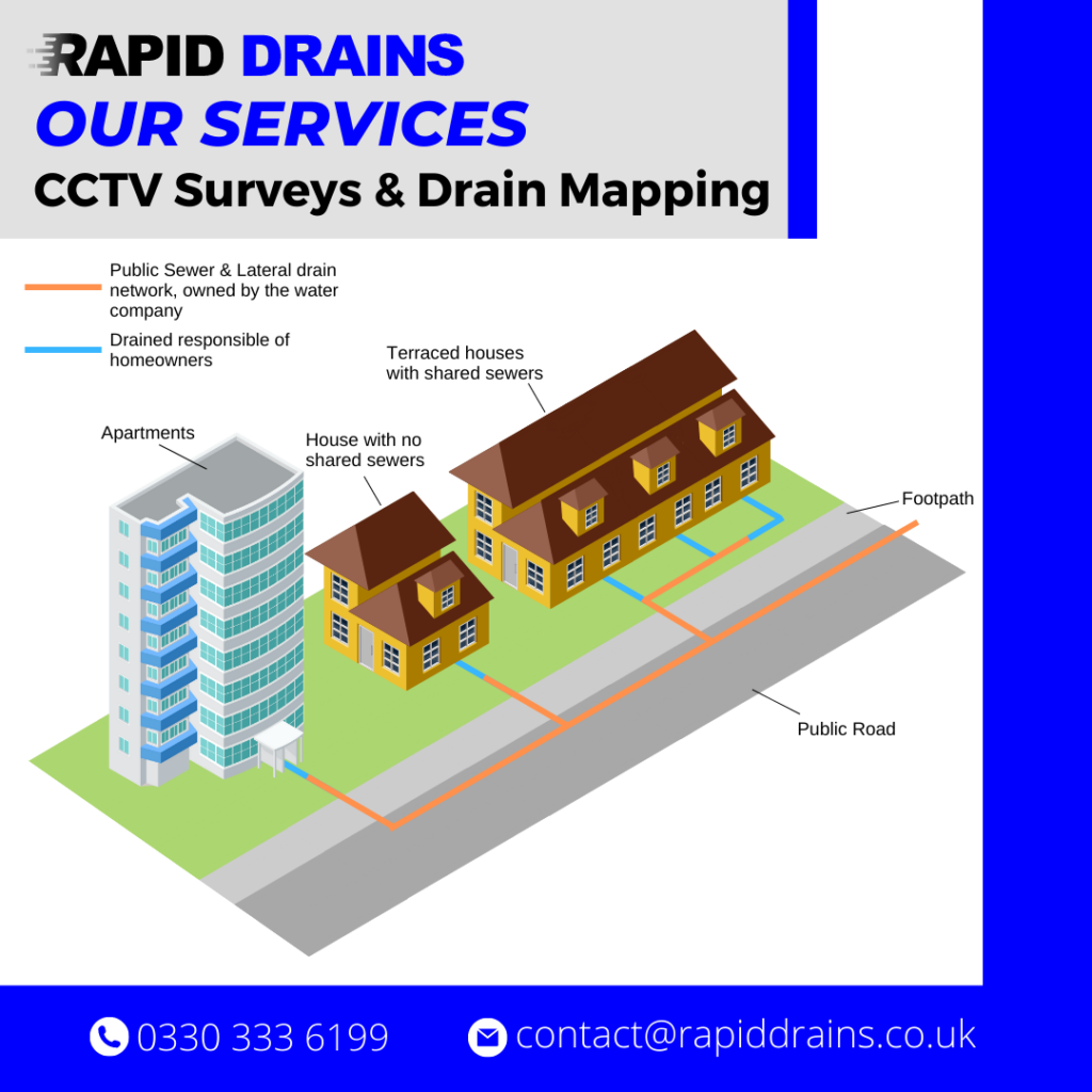
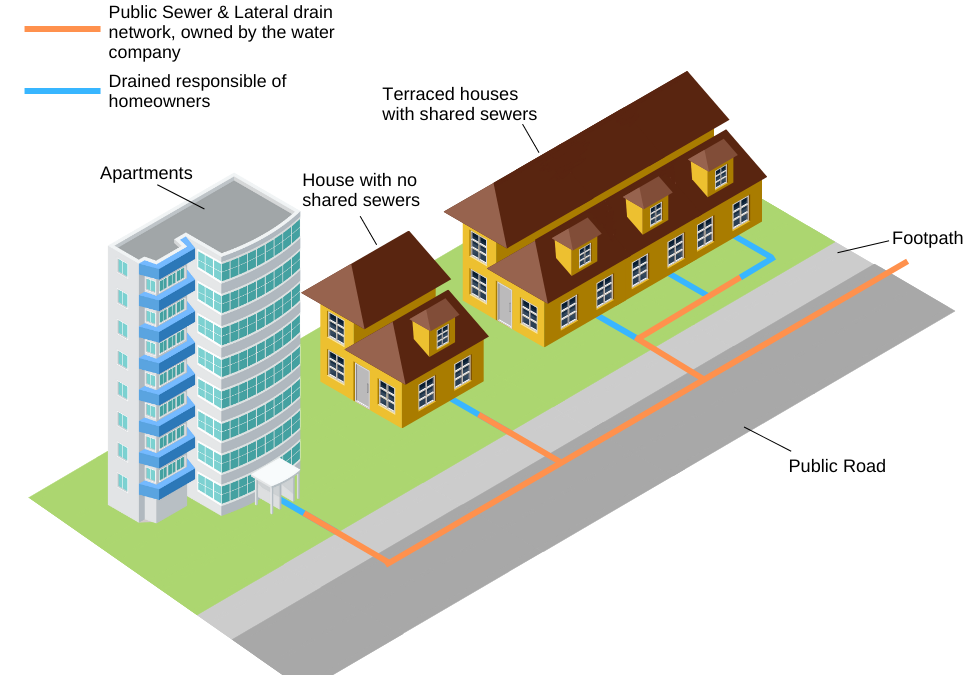
However, it is important to understand that a sewer record is not necessarily a complete drainage plan for your property.
Private drains, altered pipework, extensions and older drainage connections may not appear on the available records.
A map may show a public sewer crossing or running near the property without showing exactly how individual toilets, gullies, downpipes or waste connections reach it.
If you need to know what is actually underground, further investigation may be required.
We have included direct links to the main UK water company sewer and drainage map services at the bottom of this guide.
Check Your Local Council or Building Control Records
Your local authority may hold historic planning or building control documents for the property.
These can sometimes include:
- Original drainage layouts
- Building plans
- Extension plans
- New drainage connections
- Inspection chamber locations
- Alterations carried out during previous building work
Search your council's online planning portal using the property address.
For older records that are not available online, you may need to contact the council's planning or building control department directly.
Bear in mind that an old drawing shows what was planned or recorded at the time. It does not necessarily confirm the exact location or condition of the drainage system today.
Pipework may have been altered, replaced, abandoned or extended since the original plans were produced.
Check Your Property Documents
If you own the property, check the documents supplied when it was purchased.
Useful drainage information may be contained within:
- Conveyancing searches
- Drainage and water searches
- Previous survey reports
- Building control documents
- Extension plans
- Architect's drawings
- Drainage repair reports
- Previous CCTV survey reports
A drainage and water search completed during a previous property purchase may identify public sewers, water mains and other recorded infrastructure around the property.
However, these documents may still not provide a detailed map of the property's private drainage system.
Ask the Developer, Builder or Previous Owner
For newer properties, the original developer or builder may hold drainage drawings showing how the property was constructed.
These can be particularly useful for:
- New-build estates
- Recently converted buildings
- Commercial developments
- Properties with recent extensions
- Developments using private drainage or pumping systems
Previous owners may also have retained plans, invoices or reports from drainage work carried out in the past.
Look for Manholes and Inspection Chambers
Visible drainage features around the property can provide useful clues about how the system is arranged.
Look for:
- Manhole covers
- Inspection chambers
- Drainage gullies
- Soil vent pipes
- Rainwater downpipes
- Channel drains
- Rodding points
The position of these features can help indicate where underground pipes are likely to run.
However, drainage layouts are not always straightforward.
Manholes can become buried beneath patios, extensions, driveways, landscaping or decking, and underground pipes do not always follow the route you might expect.
Guessing the position of drainage is particularly risky before excavation or building work.
What If There Are No Drainage Plans?
This is common, particularly with older properties.
Even where plans exist, they may be incomplete or no longer accurately represent the drainage system underground.
In these situations, the drainage can be investigated directly.
A professional CCTV drain survey uses specialist camera equipment inserted into accessible drainage pipes to investigate the system.
Depending on access and the layout of the drainage, an investigation can help establish:
- Where drains run
- Which direction they flow
- How different pipes connect
- Where manholes and junctions are located
- Whether pipes carry foul or surface water
- The approximate route of underground pipework
- Whether hidden or previously unknown connections exist
- Whether the drainage contains defects or blockages
This provides information based on the drainage system that is actually present rather than relying solely on historic records.
Can a CCTV Drain Survey Create a Drainage Plan?
A CCTV drainage survey can be combined with observations from manholes, pipe connections and other accessible drainage features to establish the layout of a drainage system.
The resulting information can be used to produce a drainage plan showing known pipe routes, manholes and connections.
This can be particularly useful when:
- Planning an extension
- Buying or selling a property
- Investigating recurring drainage problems
- Locating drains before excavation
- Planning drainage repairs
- Identifying unknown connections
- Establishing foul and surface water drainage routes
Where more precise underground positioning is required, additional drain tracing or locating techniques may be used alongside CCTV inspection.
Finding Drainage Plans Before Building an Extension
It is particularly important to establish the drainage layout before building an extension or carrying out significant groundworks.
An unknown drain or public sewer beneath a proposed building area can affect the design of foundations and may require additional investigation or approval before work begins.
Existing records are a useful starting point, but they should not always be relied upon as proof of the exact position of underground pipework.
If the location of a drain is critical to the proposed work, physically investigating the drainage before construction can reduce the risk of unexpected discoveries once excavation has started.
Finding Drainage Plans When Buying a House
Standard property searches can provide useful information about recorded public drainage, but they do not normally tell you the condition of the private drains serving the property.
A drainage system may appear perfectly normal above ground while containing:
- Cracked pipes
- Root ingress
- Displaced joints
- Deformation
- Scale deposits
- Poorly constructed connections
- Partial collapses
- Previous defective repairs
For this reason, buyers who want to understand both the layout and condition of the drainage can consider a Home Buyer Drain Survey.
A CCTV inspection can provide significantly more information about what is actually underground than relying on drainage records alone.
Drainage Plans Are Not Always Accurate
It is worth treating any historic drainage or sewer plan as a useful reference rather than definitive proof of what is underground.
Properties and drainage systems change over time.
Extensions are built, drains are diverted, old pipes are abandoned, new connections are installed and manholes can disappear beneath later construction.
This is why a drainage map and a physical drainage survey serve different purposes.
Existing records tell you what is recorded.
A drainage investigation helps establish what is actually there.
Need to Locate or Map Your Property's Drains?
If you cannot find reliable drainage plans, or need to establish the actual route and condition of underground pipework, Rapid Drains can investigate the drainage system using professional CCTV inspection and drainage tracing equipment.
Our CCTV Drain Survey service can help identify pipe routes, connections and drainage defects, with recorded footage and findings available where required.
For people purchasing a property, our Home Buyer Drain Surveys provide a more detailed assessment of the underground drainage before completion.
Need help locating your drains or investigating an unknown drainage system?
Contact Rapid Drains or call 0330 333 6199 to discuss your property and the type of drainage investigation required.
Request a Sewer or Drainage Map From Your Water Company
If you are looking for an existing sewer record or water company asset map, use the relevant provider below.
These records generally show recorded public sewers and water company assets. They may not show private drains, individual property connections or every pipe that exists underground.
Southern Water
For properties within the Southern Water sewerage area, use their current Maps & Searches service. Sewer and water maps can be requested through their mapping partner, Digdat.
Southern Water – Request a Sewer or Water Map
Wessex Water
Wessex Water provides a free online service allowing you to request plans showing recorded water mains and sewers near a property or development site.
Thames Water
Thames Water Property Searches provides drainage, water and asset information, including searches showing known Thames Water sewerage and clean-water assets.
Thames Water – Property Searches and Sewer Maps
South West Water
South West Water provides property and asset information covering its network. Property owners may also be able to request asset plans showing recorded South West Water infrastructure.
South West Water – Property Searches
Severn Trent Water
Severn Trent provides water and sewer maps through its dedicated map-request service, with mapping supplied through Digdat.
Severn Trent – Request a Water or Sewer Map
United Utilities
Formerly associated with the North West Water name, United Utilities covers much of North West England and provides property searches and a map-only service for recorded water and sewer assets.
United Utilities – Property Searches and Asset Maps
Anglian Water
Anglian Water provides access to its sewer records through the Digdat online mapping service. Their guidance explains how to obtain information about public sewers near a property.
Anglian Water – How to Obtain Sewer Records
Dŵr Cymru Welsh Water
Dŵr Cymru Welsh Water provides plans showing the approximate location of recorded water mains and public sewers near properties and development sites.
Welsh Water – Maps of Water Mains and Sewers
Yorkshire Water
Yorkshire Water provides sewer and water-main records through SafeMove, its specialist property-search service. Electronic or paper plans can be ordered online.
Yorkshire Water / SafeMove – Order Sewer and Water Plans
Frequently Asked Questions
Where can I get drainage plans for my house?
Start by checking your local water company's sewer records, your council's planning or building control records and documents supplied when you purchased the property. For newer properties, the developer may also hold drainage drawings.
Does the water company have plans of all my drains?
No. Water company maps mainly show recorded public sewers and other assets owned or managed by the water company. Private drains and individual property connections are often not shown.
Can I find drainage plans online?
In many areas, yes. Water companies increasingly provide online sewer-map ordering or asset-search services. Historic planning and building documents may also be available through your local council's online planning portal.
What if my property has no drainage plans?
A CCTV drainage investigation can help establish the actual layout of accessible underground drains, including pipe directions, connections and manholes.
Can you find a drain that is not shown on any plans?
In many cases, yes. Unknown drainage can often be investigated using CCTV cameras, accessible manholes and specialist tracing or locating equipment. The method required depends on the drainage system and available access.
Why isn't my private drain shown on the sewer map?
Water company asset maps are primarily records of public infrastructure. Private pipework serving an individual property may not form part of their mapped network, and older or transferred sewers may also be incompletely recorded.
Do I need a drain survey before buying a house?
It is not normally mandatory, but a drain survey can identify defects and drainage problems that are not visible during a standard building survey or shown on sewer records. A specialist Home Buyer Drain Survey can assess accessible underground drainage before purchase.